The research layer
Everything underneath the island guide: photographs, maps, primary sources, people, and the questions still unresolved. Each image is anchored to a place, a person and a moment — nothing here is decorative.
 ca. 1888 · Manuscript plan
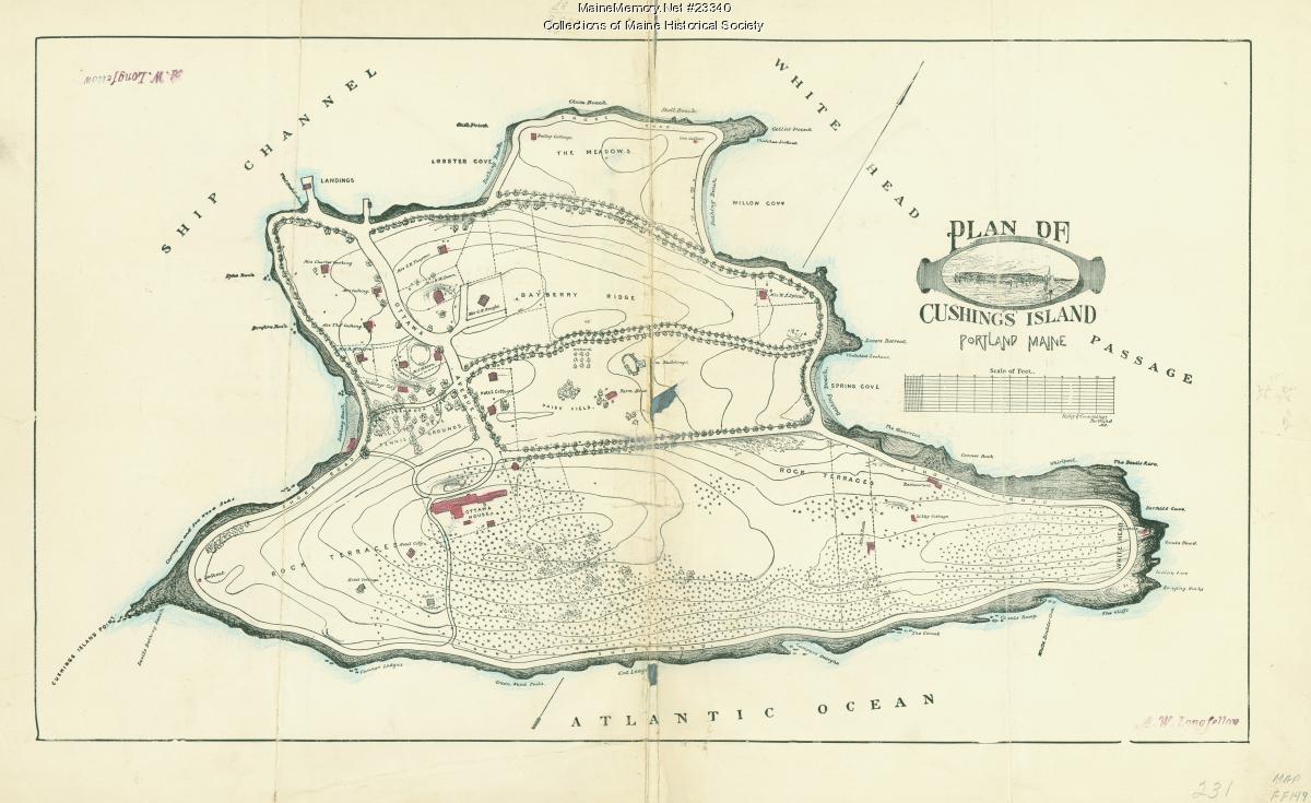
Plan of Cushing Island, ca. 1888
Manuscript plan naming Bayberry Ridge, Rock Terrace, the Meadows, Lobster Cove, Spring Cove, and White Head. The Maine Historical Society record dates it ca. 1888 and names no draughtsman, though the sheet itself carries an A. W. Longfellow signature at lower right. The 1885 date given in some accounts is not carried by the record.
Collections of Maine Historical Society · Maine Memory Network #23340Provenance & full view →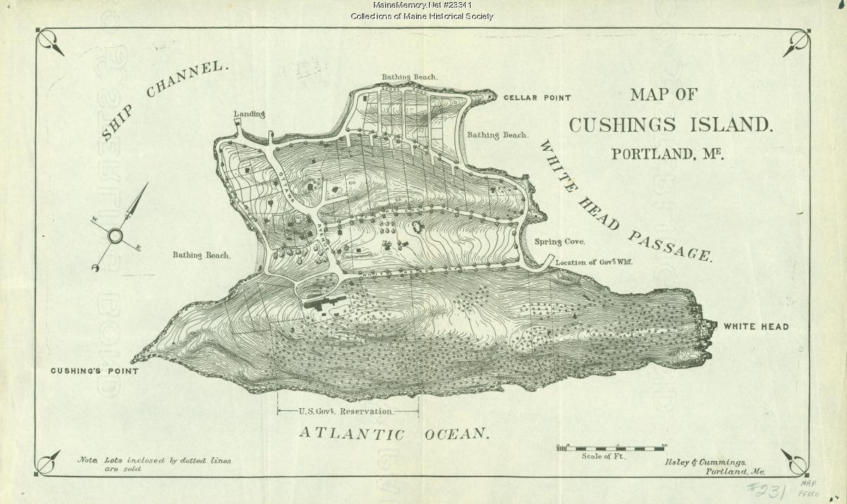 ca. 1888 · Printed map
Map of Cushing Island, ca. 1888
The 1888 printed map used to sell lots — dotted outlines mark parcels already sold. The Ottawa House stands at the western bluff; the U.S. Government Reservation (future Fort Levett) is blocked out on the southern shore.
Collections of Maine Historical Society · Maine Memory Network #23341Provenance & full view →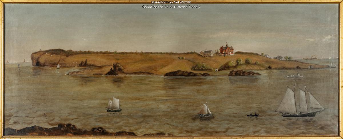 ca. 1870 · Oil on canvas
Cushing Island, Portland Harbor, ca. 1870
An oil view of the island from the water, catalogued as ca. 1870 — early enough that the hotel shown is the first Ottawa House, not the 1888 replacement. Useful for setting and silhouette, unreliable for measurement.
Unattributed · Maine Memory Network #52394Provenance & full view →Related places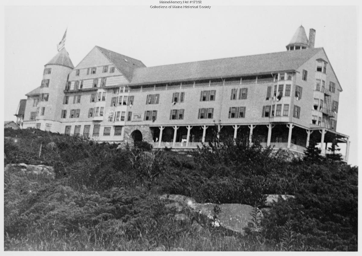 ca. 1900 · Photograph
Ottawa House, Cushing Island, ca. 1900
The second Ottawa House, built in 1888 after the first burned. The catalogue record describes a hotel accommodating about 300 guests, with nightly dancing in a large ballroom and a bathing pavilion at Willow Beach. It burned in 1917 and was not rebuilt.
Collections of Maine Historical Society · Maine Memory Network #17392Provenance & full view →Related placesRelated people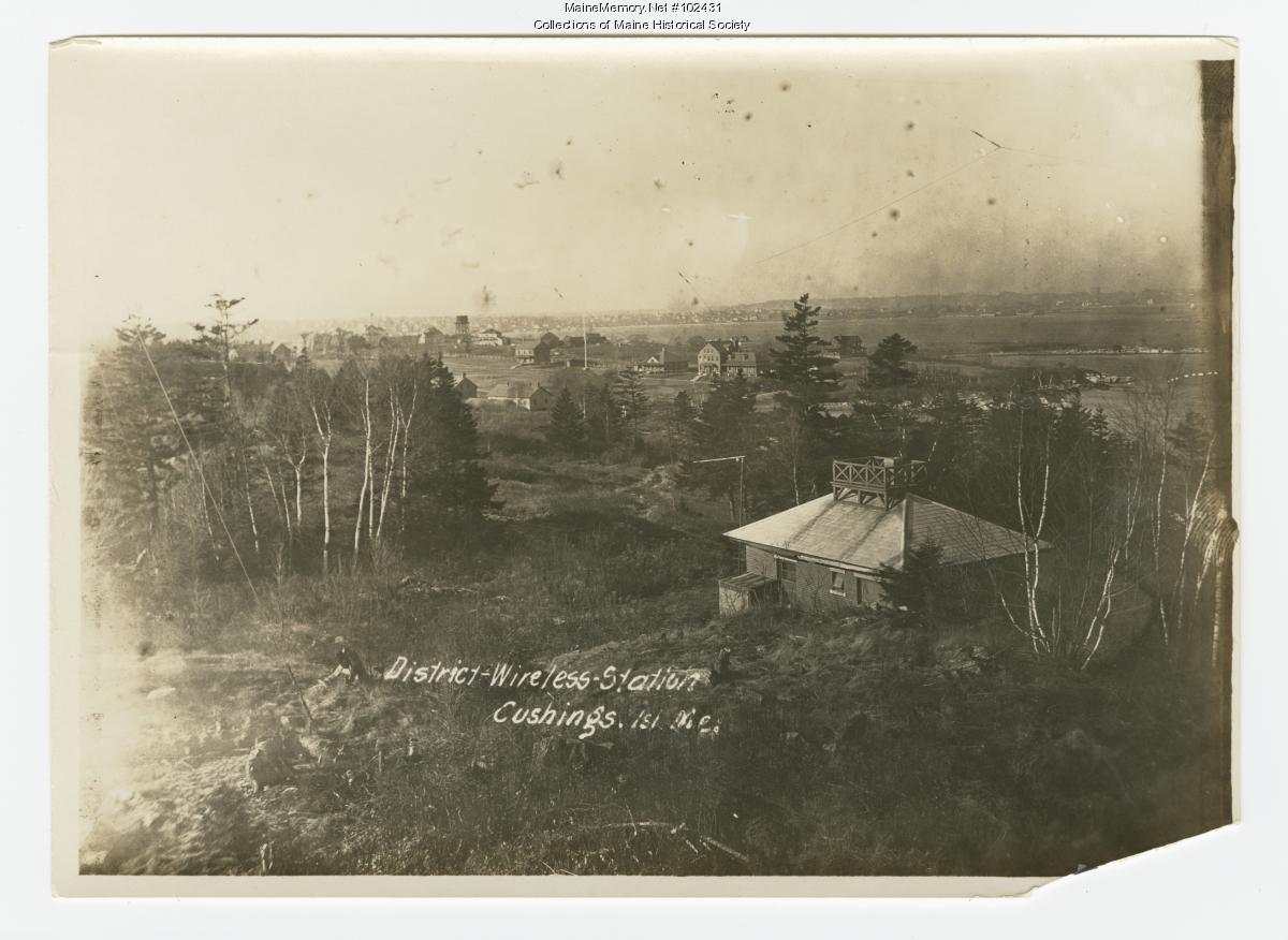 ca. 1914 · Photograph
District-Wireless Station, Cushing Island, Maine, ca. 1914
A shingled hut with an antenna platform on the roof, looking north across the island toward Munjoy Hill and the Portland Observatory. A single figure sits on the ledge below with signal wires visible against the sky.
Collections of Maine Historical Society · Maine Memory Network #102431Provenance & full view →Related places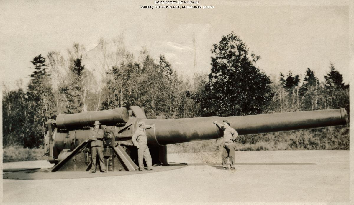 Undated · Photograph
Coastal gun and crew, Fort Levett
Soldiers beside a large coast-defence rifle on its carriage. Which battery and which emplacement is not established by any record consulted here, and the calibre should not be read off the photograph.
Courtesy of Tom Richards · Maine Memory Network #105419Provenance & full view →Related places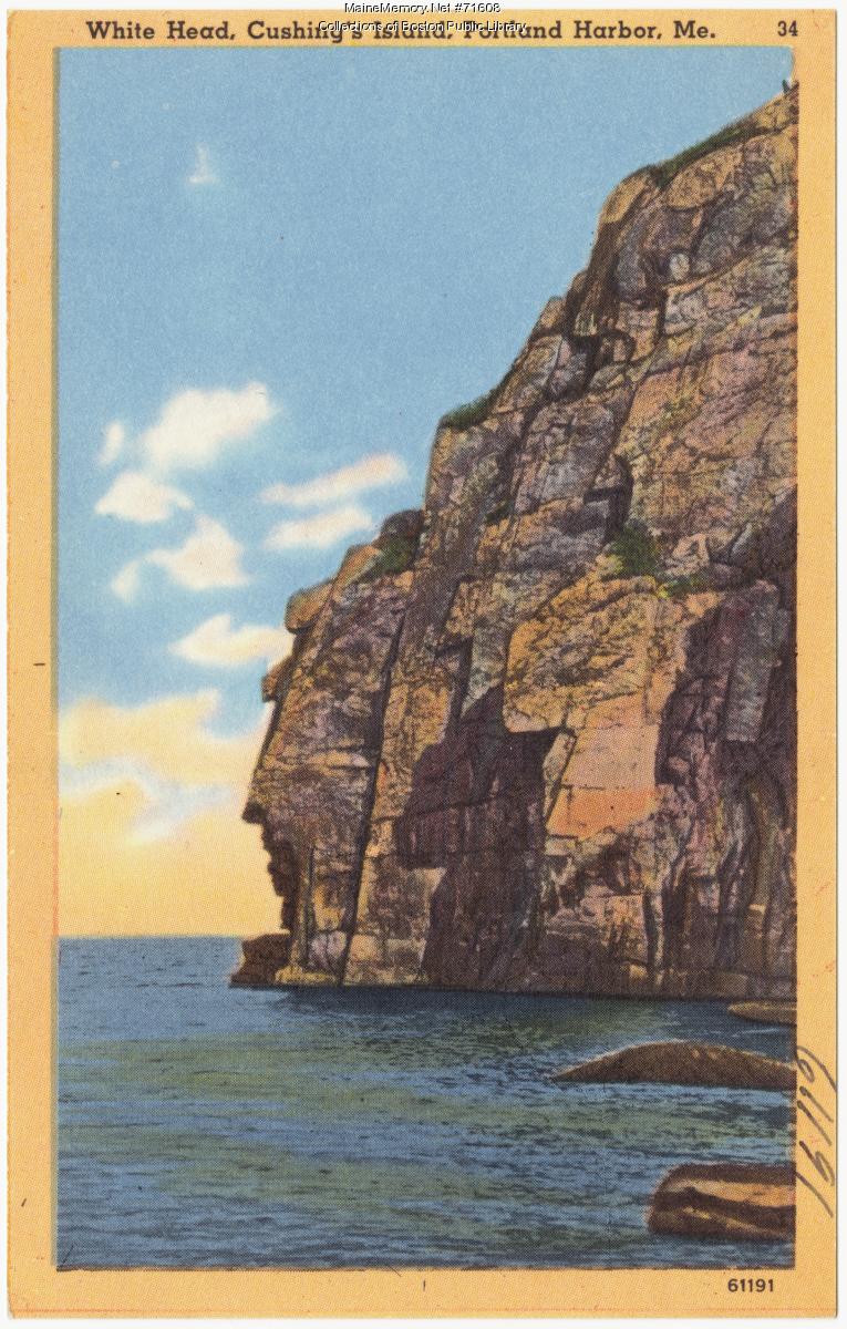 ca. 1928 · Colour linen postcard (#61191)
White Head, Cushing Island, Portland Harbor, ca. 1928
A colour postcard of the White Head cliffs, catalogued ca. 1928 — the island's most reproduced view, sold to visitors long after the hotel had burned.
Collections of Boston Public Library · Maine Memory Network #71608Provenance & full view →Related places