Military · 1917–1919
District Wireless Station Site
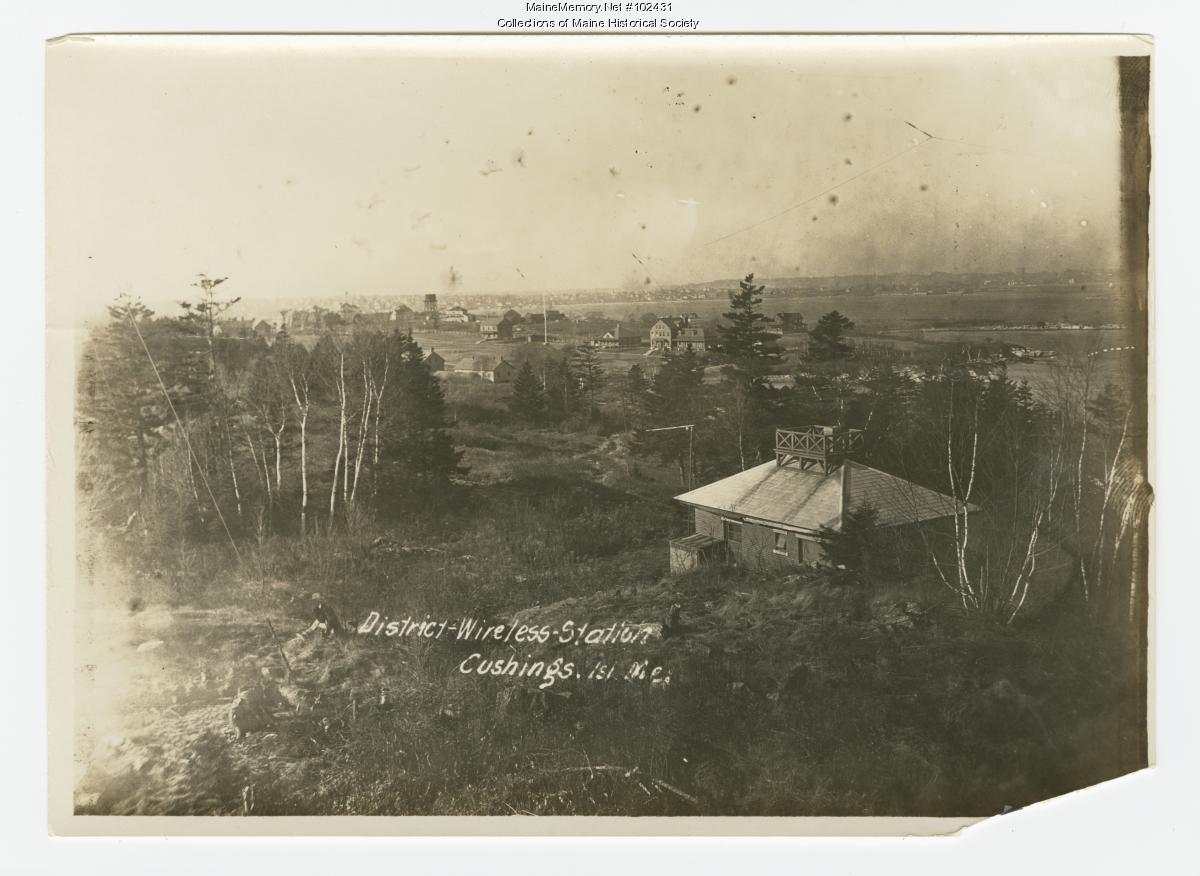
1917 Navy radio hut on the north bluff
[HC]High-Confidence Inference43.64400° N, 70.19450° WApproximate
In layers04 · Fortress Cushing
Position — The station is documented by one photograph. Its position here is inferred from the photograph's northward sight-line and remains unlocated in the strict sense.
Historical significance
During the First World War the U.S. Navy operated a small District Wireless Station on Cushing to relay coastal traffic. A single surviving photograph shows a shingled hut with an antenna platform on the roof, looking north toward Munjoy Hill.
On the ground
- A cleared, elevated bench with a clean sight-line toward Portland.
- Guy-wire anchor points and disturbed soil are the most likely surface traces.
- The building itself was small — foundation, if any, would be modest.
Engineering / Landscape reading
Wireless huts of this period needed elevation, a clear northern arc, and grounded antenna anchors — not a fortified footprint. Look for the geometry of the anchors, not the walls.
Open research questions
- 1.Which of the several elevated benches on the north side matches the sight-line in the 1917 photograph?
- 2.Was the station wired into Fort Levett's fire-control network, or independent of it?
From the archive
Where to walk next
Fort Levett — Battery Foote
120 m · ~1 minEndicott-era coastal artillery
Levett's Cellar & Spicer's Cove
730 m · ~9 minLevett's 1623 settlement site
Distances are straight-line from recorded coordinates. Island roads curve, so allow more time than the estimate.
How we know
What else stood here
- 1898–present — Battery Foote
Continue the trail
- 01Stand at Levett's Cellar & Spicer's CovePlace · Levett's Cellar & Spicer's Cove — Colonial · 1623
- 02Look at the evidence: District-Wireless Station, Cushing Island, MaineSource · District-Wireless Station, Cushing Island, Maine — ca. 1914 · Maine Memory Network / Maine Historical Society
- 03Read the whole layer: Fortress CushingLayer · Fortress Cushing — Layer 04 · 1898 → 1947
- 04Stand at Fort Levett — Battery FootePlace · Fort Levett — Battery Foote — Military · 1898–1945