The Ottawa House
A hotel that shaped an island for sixty years, burned in a single day, and left almost nothing you can point at.
For roughly sixty seasons, Cushing Island's public face was a large Victorian resort on the western bluff. Guests came by Casco Bay Line steamer, landed on the west shore, and were carried up a graded track to the terrace. The hotel is documented in photographs, in an oil painting of the island seen from the Ship Channel, in Sargent's 1886 prospectus, and on the 1888 lot map — four sources that agree it existed and are not equally good at telling us where.
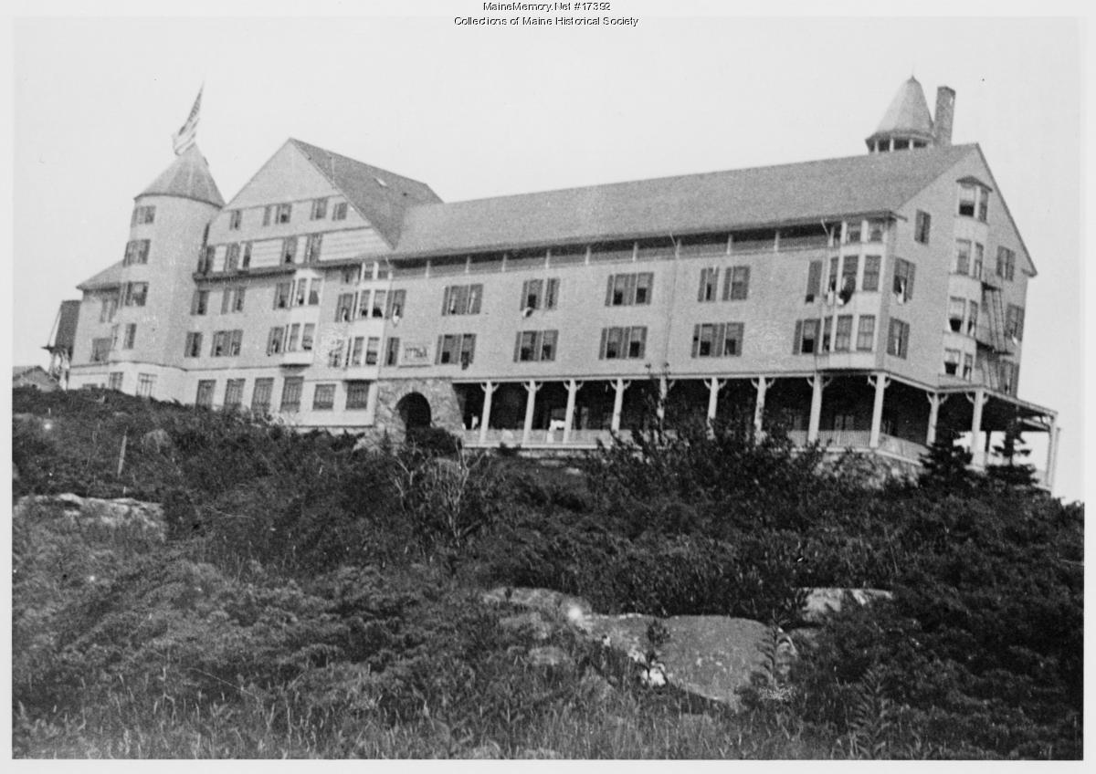 Examine
The building itself, photographed from below the front lawn.
Ottawa House, Cushing IslandSargent's Historical Sketch is the fullest contemporary description, and it is worth reading with its interests in mind: the same volume is a prospectus for selling island lots. Harrison Bird Brown's paintings and John Calvin Stevens's cottage plates are part of the same commercial project — an island being made into an image.
 Examine
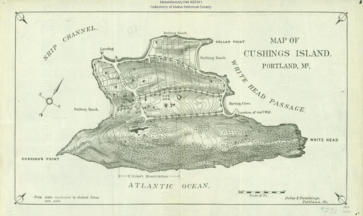
The year the lots were selling — and the sheet that could still fix the hotel's footprint.
Map of Cushing IslandCalumet Avenue
A road is the most conservative thing on an island: it outlasts the buildings it was built to reach. Calumet Avenue is named on the resort-era survey and still carries traffic today.
- 1885Surveyed
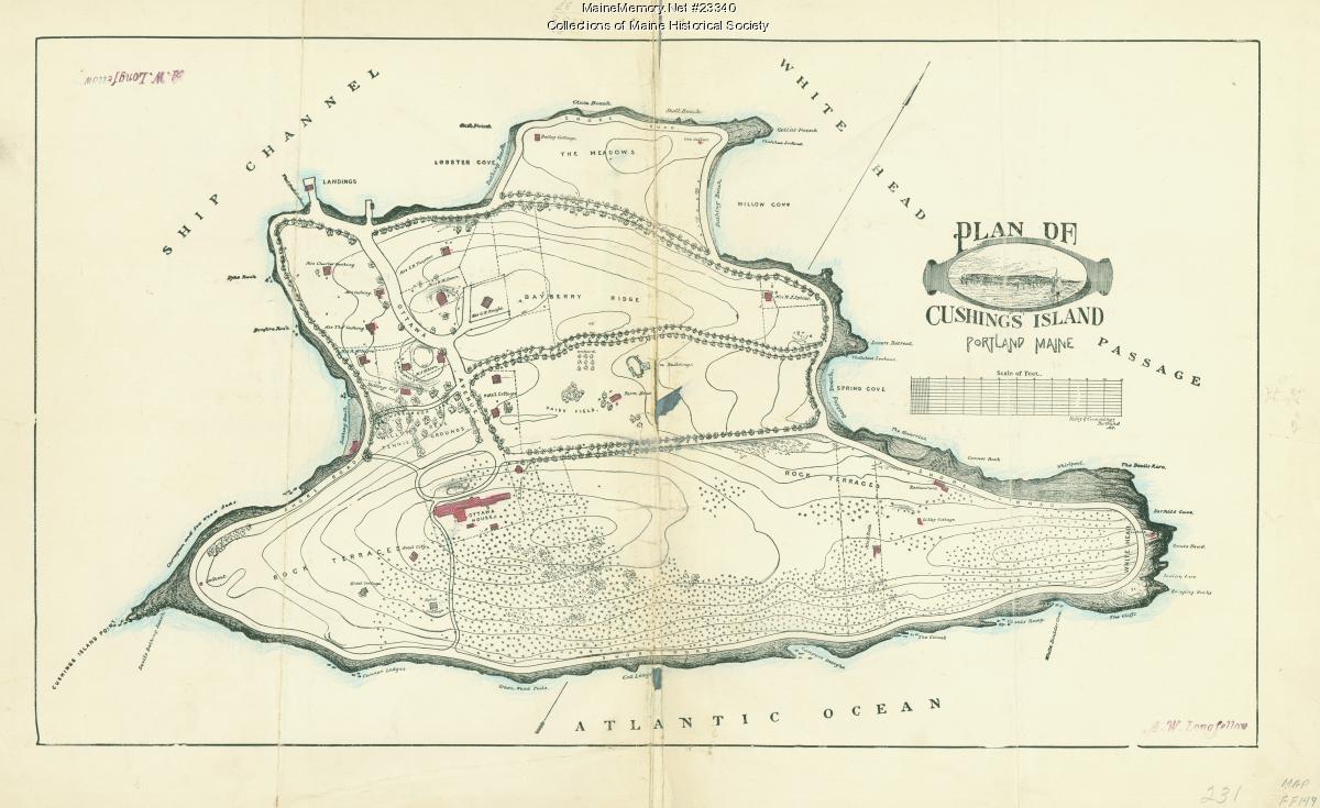
A. W. Longfellow's manuscript plan lays out the island's named features — Bayberry Ridge, Rock Terrace, the Meadows, Lobster Cove, Spring Cove, White Head. The road network of the summer island is being drawn before most of it is built.
[DOC]Source → - 1888Sold
The Ilsley & Cummings lot map shows parcels already sold in dotted outline along the island's roads, and blocks out the southern shore for the United States Government. The avenue is now a property line as much as a route.
[DOC]Source → - 1917TransitionNo image held for this period
The Ottawa House burns. What the road served at its western end no longer exists; what it serves at its southern end — the fort — is expanding. No image of the avenue in this year is held here.
[DOC] - 1943Military landscapeNo image held for this period
The southern end of the island is a working coast-defense reservation. Whether the resort-era roads were regraded for military traffic, and where, is not established by any source in this history.
[POS] - TodayStill in useNo image held for this period
Sunken road cuts, stone walls parallel to grade, and long-worn shoulders. This history treats the road corridor as a layered feature: Wabanaki travel, colonial path, resort avenue and service route are not separable on the ground without excavation.
[HC]Stand here →
In 1917 the hotel burned. This history records the fact and the year; it does not have a contemporary newspaper account of the fire, a casualty record, or an image of the aftermath. What survives on the ground is negative evidence — path edges, gathering points worn flat, carriage cuts through the terrain — which is why the site's field value is high even though its architecture is gone.
- 01See what remains on the groundPlace · Ottawa House Grounds — Resort · 1858–1917
- 02How did guests reach the island?Place · Steamboat Wharf & Ottawa Landing — Resort · 1858–1917
- 03Who wrote the island's history — and why?Person · Wm. M. Sargent, A.M. — Author of the 1886 Historical Sketch — this site's primary source
- 04Open the case file on the hotel groundsCase file · The Ottawa House — Case file IV
- ?Where exactly did the hotel stand? The 1888 map should answer this.
- ?What does a contemporary newspaper account of the 1917 fire say?
- ?Are there guest registers, advertisements, or timetables for the steamer service?