The Island Today
What is still standing, and what is only a shape in the ground.
Cushing is a private residential community that stewards a shoreline carrying every prior chapter. Concrete outlasts timber, so the fort reads clearly and the resort barely at all; roads outlast both. This layer is where present-day observation, rather than archive work, carries most of the weight — the surviving structures, roads and ground disturbances recorded here.
What does a systematic, permission-based surface survey of the Ottawa House terrace actually find?
- TodayOngoing stewardship
Cushing Island is a private community that continues to steward the landscape across all of its layered histories.
Calumet Avenue
A road is the most conservative thing on an island: it outlasts the buildings it was built to reach. Calumet Avenue is named on the resort-era survey and still carries traffic today.
- 1885Surveyed
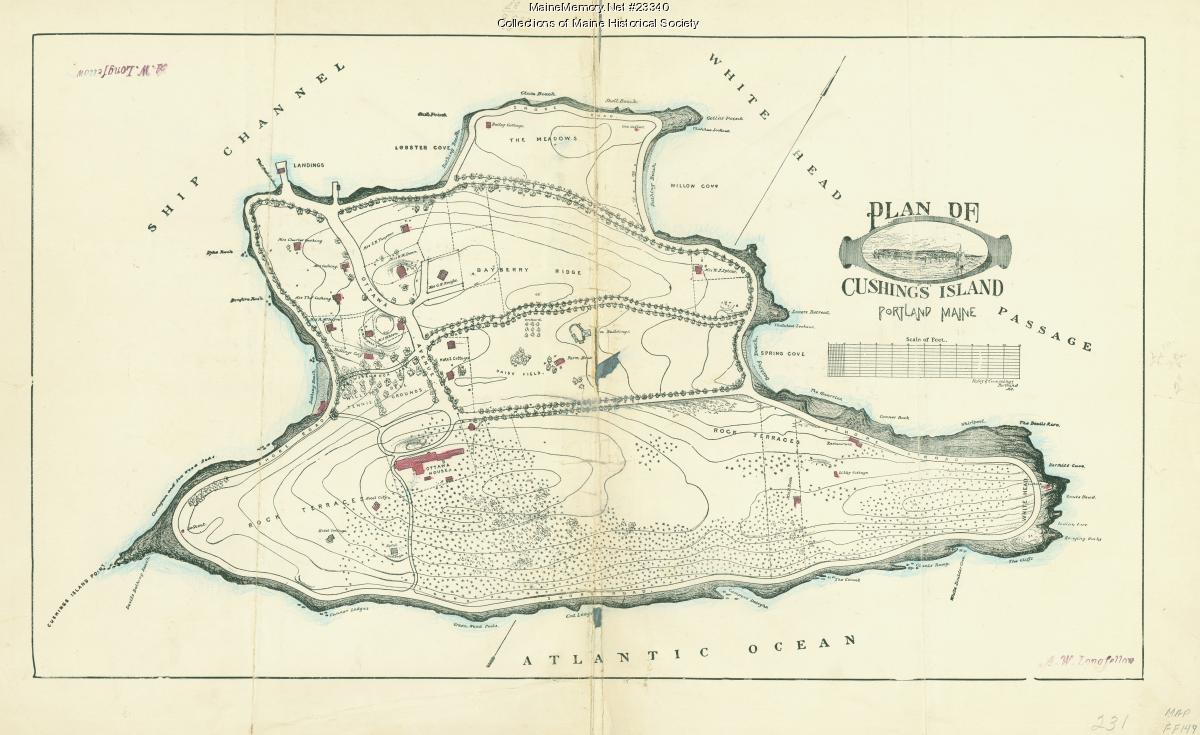
A. W. Longfellow's manuscript plan lays out the island's named features — Bayberry Ridge, Rock Terrace, the Meadows, Lobster Cove, Spring Cove, White Head. The road network of the summer island is being drawn before most of it is built.
[DOC]Source → - 1888Sold
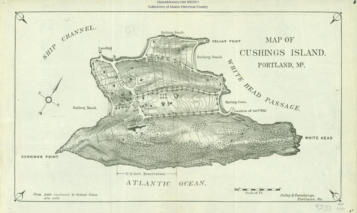
The Ilsley & Cummings lot map shows parcels already sold in dotted outline along the island's roads, and blocks out the southern shore for the United States Government. The avenue is now a property line as much as a route.
[DOC]Source → - 1917TransitionNo image held for this period
The Ottawa House burns. What the road served at its western end no longer exists; what it serves at its southern end — the fort — is expanding. No image of the avenue in this year is held here.
[DOC] - 1943Military landscapeNo image held for this period
The southern end of the island is a working coast-defense reservation. Whether the resort-era roads were regraded for military traffic, and where, is not established by any source in this history.
[POS] - TodayStill in useNo image held for this period
Sunken road cuts, stone walls parallel to grade, and long-worn shoulders. This history treats the road corridor as a layered feature: Wabanaki travel, colonial path, resort avenue and service route are not separable on the ground without excavation.
[HC]Stand here →
White Head
The one feature on Cushing that every period agrees on. Painted, printed, charted, and still there — which makes it the island's control point for reading everything else.
- 1885Named on the plan
White Head appears as a named feature on Longfellow's plan, alongside Spring Cove and the Meadows.
[DOC]Source → - 1886PaintedNo image held for this period
Harrison Bird Brown paints the cliff for Sargent's Historical Sketch. The image the island sells of itself starts here.
[DOC]Source → - c. 1930s–50sPrinted
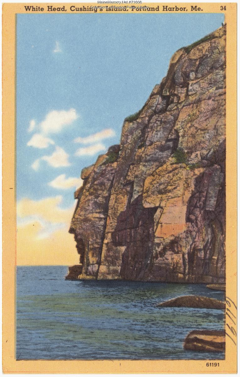
A linen postcard reproduces the same face for the tourist trade — the picture outliving the painting by half a century.
[DOC]Source → - TodayUnchangedNo image held for this period
Vertical joint fractures, a weathered profile in the south wall often read as a face, deep water at the base. The cliff is this site's most reliable then-and-now comparison because it has barely moved.
[DOC]Stand here →
- 01Stand at White HeadPlace · White Head — Landscape · All eras
- 02Look at the evidence: White Head, Cushing Island, Portland Harbor, ca. 1928Source · White Head, Cushing Island, Portland Harbor, ca. 1928 — ca. 1928 · Boston Public Library
- 03Stand at Calumet & Whitehead AvenuesPlace · Calumet & Whitehead Avenues — All eras
- 04Stand at Fort Levett Parade & Fire-Control ComplexPlace · Fort Levett Parade & Fire-Control Complex — Military · 1898–1947
- 05Stand at Government DockPlace · Government Dock — Today · Fort era → present
- 06Stand at Civilian DockPlace · Civilian Dock — Today · Present-day island